Coming to know a favorite place to photograph
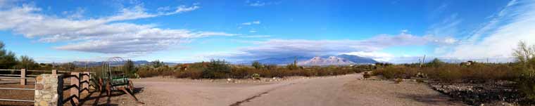
A panorama of Raggedtop Mountain.
Over the years I have had many favorite places for landscape photography.
CLICK IMAGE TO VIEW LARGER
Most are in Arizona and New Mexico, and many are related to my years as a geology student interested in the structural geology of the moon.
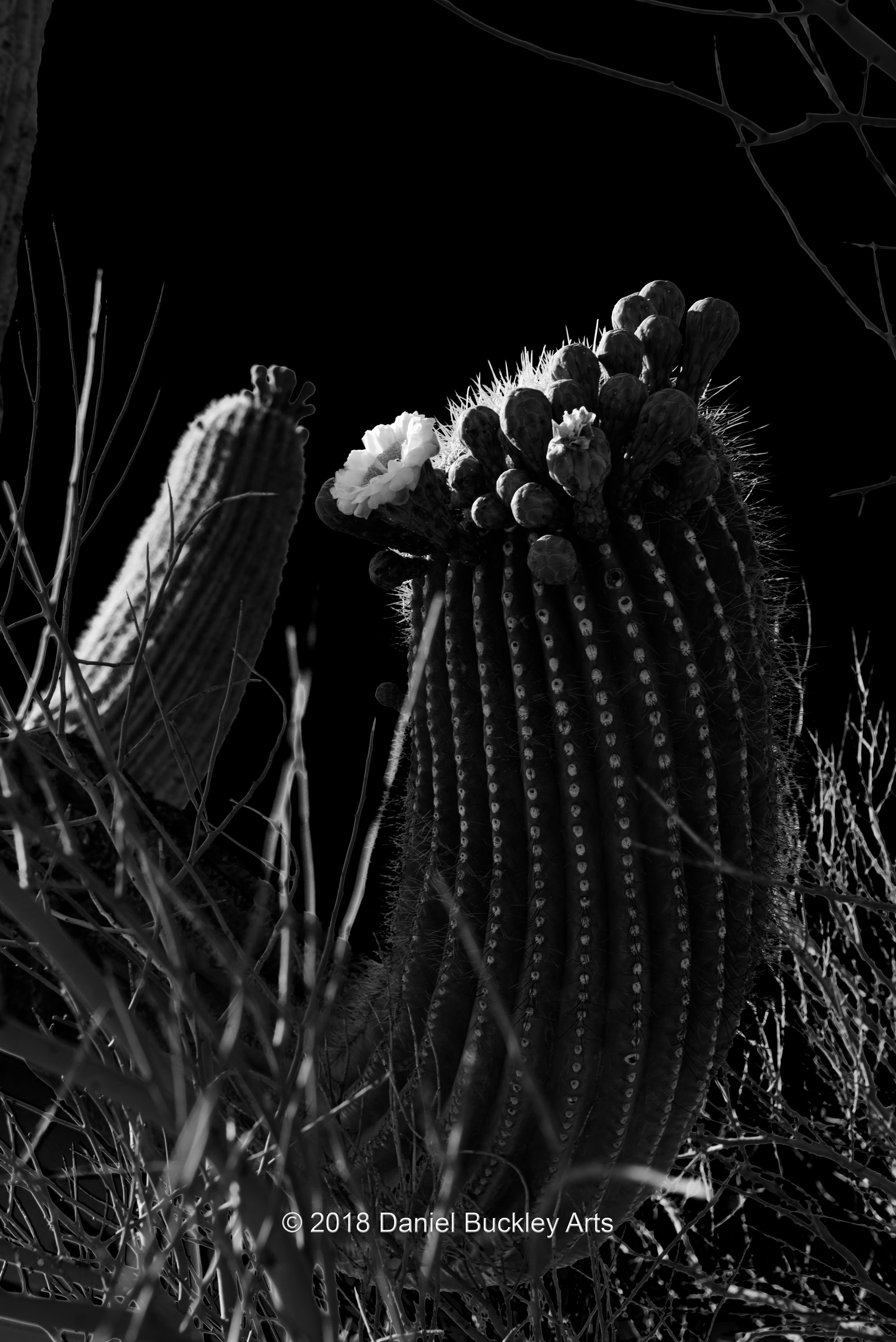
I had a broad area west of the Tucson Mountains in the early 1970s that became my field mapping area for a course on geomorphology. It was a versatile area of the Sonoran desert where the iconic giant saguaro cacti were interspersed with features related to fluvial processes (water erosion), former volcanic activity and a hodgepodge of crazy stuff they called the Tucson Chaos.
 The roads were all dirt roads in those days and one traveled many miles in any direction before one saw a building of any sort. There were cotton fields and miles and miles of cactus, craggy rocks and radial streams fanning out from the taller peaks.
Pre-cell-phones and GPS and without a four wheel drive, my excursions into the dusty unknown territory were cautious to say the least. At times I used an altimeter, calibrated at a USGS benchmark, to find my location on topographic maps.
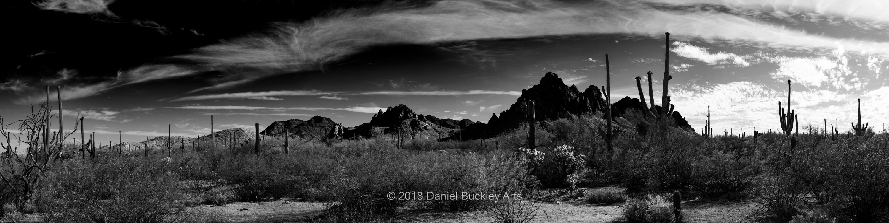
There was a place northwest of my field mapping area that had these craggy peaks that looked like that back of a stegosaurus. But it was off somewhere I never could find a road into.
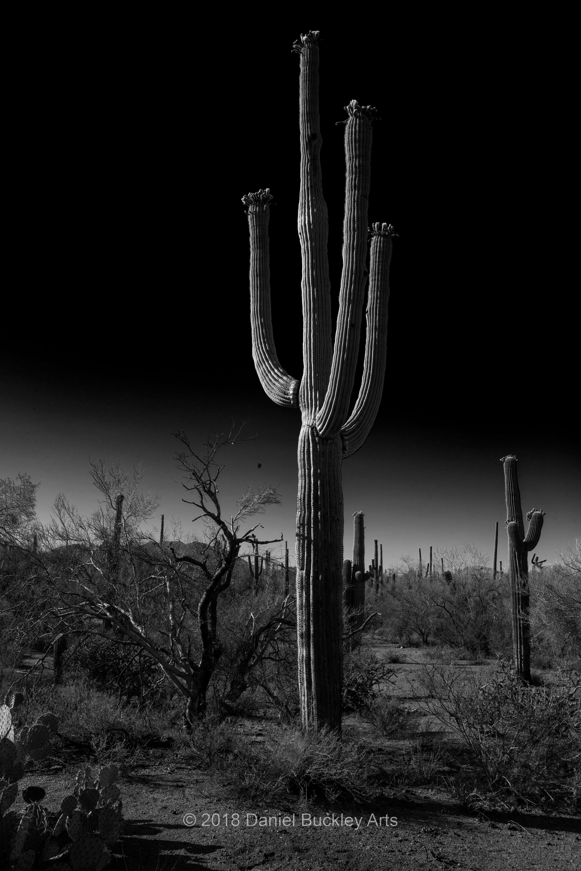
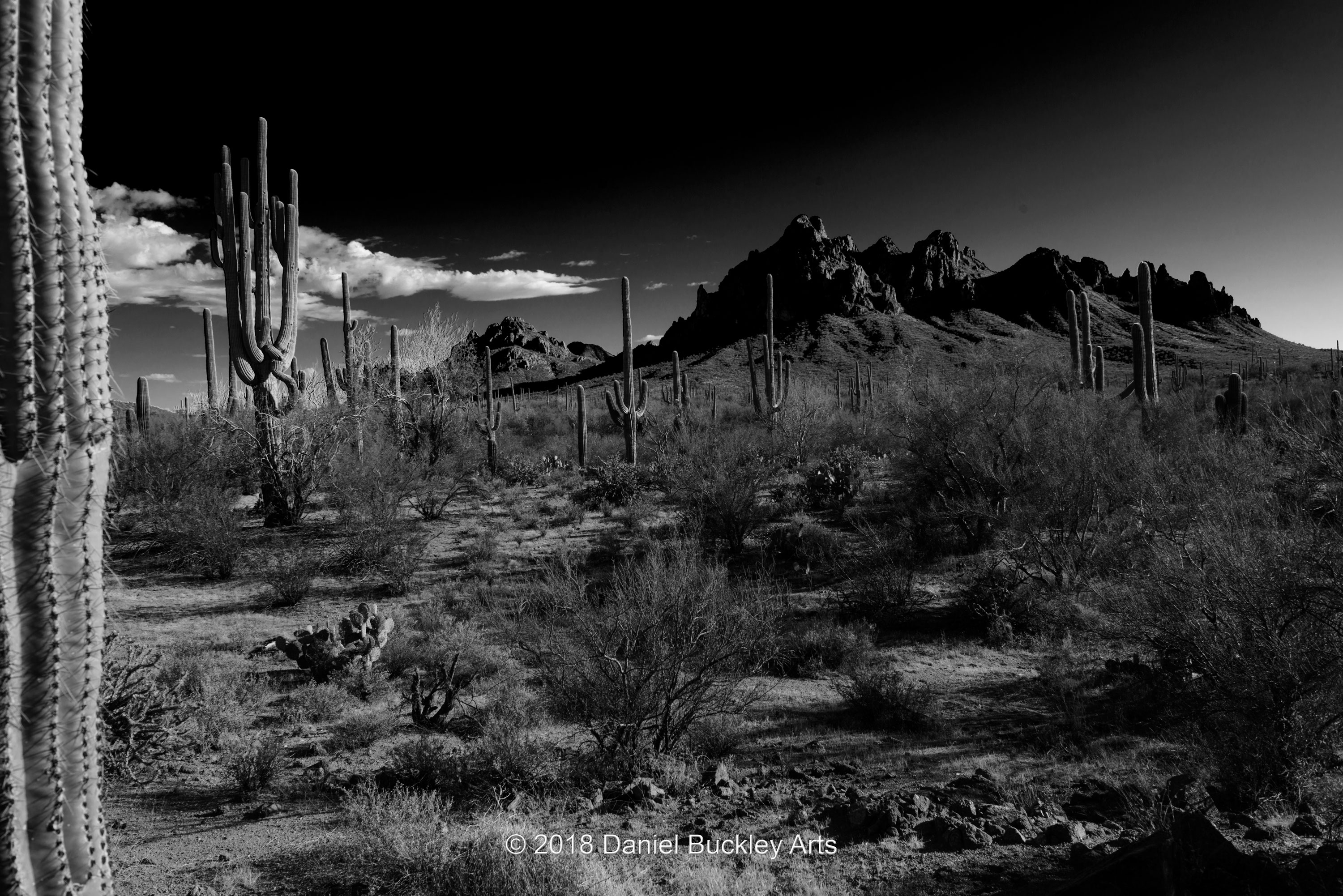
When the Trump administration added that area to its national park hit list I decided to go and photograph it. I learned it was part of the Ironwood Forest National Park and that it had some of the biggest, multi-armed saguaros anywhere in the area. The more arms a saguaro has, the longer it’s been around.
I swore that I’d find a way to get there in 2018. But my main work is in the production of the film and book project, The Mariachi Miracle. So my landscape photography often takes a back seat to that bigger project. Still, I needed an intellectual break from that work as much as I needed to recharge my own batteries by being in an exquisite desert wilderness. And so in early February I dug out the GPS, topographic maps and more and set sail for Ironwood.
The first place GPS took me was to Avra Valley Road in Marana – one of my landmarks from my old field mapping geologist days when I’d look at soils and drainage and all kinds of subtle variables in the landscape. I would never have recognized the road. Where it had been an empty stretch of dirt road it was now quite populated with a lot of different types of industry, from farming and mining to concrete production and more.
 The farther west I traveled the bigger the saguaros got, and some of them had more arms than I’d ever seen on a cactus before. I’d jot down location markers from the road and trek in by for ways to see what was close by. I saw signs of humanitarians groups leaving water for those attempting to cross the harsh moonscape that is that portion of the Sonoran Desert. And of course the massive tailings of the mines.
But that jagged-crested ridge lay further to the north. Feeling confident that GPS might lead me out of anywhere I got into and armed with a couple of nights of close examination of maps, Google satellite images and the like, I made my first journey into that remote area at a very judicious pace. It was dirt roads most of the way, and again I was driving a sedan, so I didn’t want to find myself stranded in the middle of nowhere with no cell phone signal. But week after week I kept coming back, traveling a little further each time while getting closer and closer to what I now knew was called Raggedtop Mountain. I became more familiar with the endless photographic subjects this area offered, and as I progressed further north, parallel to the west face of Raggedtop I could see its structure revealed as I widened my curved circuit around it.
At the same time I was learning more about the kind of gear I needed to bring with me, both to photograph and to get myself out of there if something went wrong. I learned to carry a Leatherman with plyers to yank out the spiny cholla cactus clumps that inevitably attached themselves to my shoes, clothing, bares legs and arms, etc. To bring the photographic gear needed to shoot items within that landscape from a slightly higher or lower perspective. I challenged myself to focus on a particular plant or geological features. I used GPS to map my hikes and help me find particular features again.
 I witnessed a truly remarkable spring bloom that had every desert plant in full display the likes of which I had not seen in my 47 years in Tucson. I figure I have roughly a month before the monsoon rains make travel there less of a good idea.
Everything takes time to really see in the desert. And this is a place that will take me some years to truly get to know.
It takes a while too to discover the best vantage points to capture even the biggest features. This is accelerating the growth of my photographic artistry and inspiring trademark image treatments.I am finding my more mature voice as a photographer even as I am still discovering the area. And I’ve barely scratched the surface.
At the same time I’m also trying to work some time-lapse photography into the mix, and developing the techniques to set such things up and let them go while simultaneously photographing nearby treasure across the road from the area of time-lapses and panoramic treatments. A rotating tripod head is allowing me to shift the point of view and create a moving perspective. This too will take time to learn how to best harness that new vantage point.